Bikepacking Through Kyrgyzstan
An adventure through the remote wilds of Kyrgyzstan with the Patatrack collective
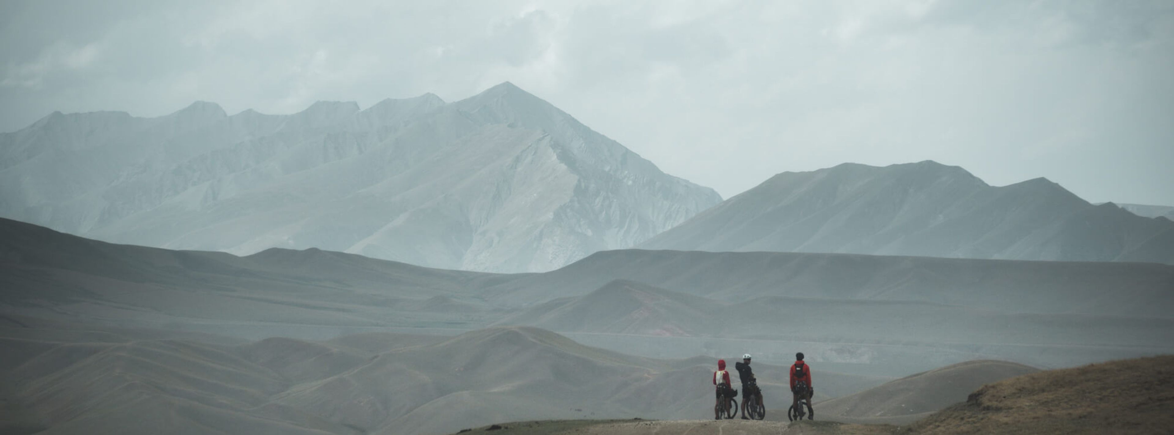
Ilaria Occhipinti and her boyfriend, along with several other members of the Patatrack collective from Italy, recently set out to bikepack across Kyrgyzstan. Below is her report from the ride...along with some of her stunning photos.
Kyrgyzstan. Kyrgyzkystan. Khirghkizstan.
Until a few days before departure, we still hadn't figured out how to pronounce the name of the country we were about to travel to. To be honest, we didn’t even know exactly where it was on the world map. You know, it's one of those countries you hear about, somewhere in Asia, "the -stans."
There are so many variables to consider when embarking on a bikepacking trip like this: mileage and elevation gain, of course, but also the isolation, harsh weather conditions, difficulty in finding water and food, constant exposure to high altitudes, the uncertainty about the road conditions, the lack of spare parts, the impossibility of communicating with locals (unless you know Russian, which unfortunately we don’t).
We have everything we need for this journey: 12 days riding through the Tian Shan mountain range, the natural border between Central Asia and China. Entire days without civilization or supplies await us.
Life during a bikepacking trip is quite simple: pedal, eat, sleep, repeat. Occasionally, some crossword puzzles…if you were clever enough to bring them from home - Russian crosswords might feel too difficult, if you don’t speak Russian. In the bags, only the essentials, or just a little more. One biking outfit, one sleeping outfit, a few layers to stay warm and dry, a tent capable of withstanding nightly storms and sudden hailstorms, a sleeping bag that's never warm enough, stove and gas canisters, dehydrated food ensuring about ten days of autonomy, a water filter. Some even indulge in a few luxuries, like a spare pair of socks or a bar of soap.
On the first day, we set out with the enthusiasm of those about to embark on a great adventure. Goosebumps and vibrant eyes, looking around to capture as many images as possible. Armed with our experience in Ladakh last year (India, Karakoram mountain range), we start off relatively calm, even though, on day 0, the number of broken derailleur hangers is already greater than zero, and the weight of the bikes hovers around 27 kg each.
If the first day is an approach - or rather, a departure - from inhabited centers, by the second day, we are forcefully thrown into the typical Kyrgyz postcard landscape. We emerge at the top of the first pass, at an altitude of 3800 meters, on a boundless plateau. Already breathless due to the altitude, we’re greeted with a strong and constant headwind. We find refuge in an isolated yurt, where a woman welcomes us, along with her presumed grandchildren, and invites us to her laden table with bread, butter, sweet jams, fried fish, and endless hot tea.
We begin the long descent through the plateau that will lead us to Naryn, the first inhabited center. Finally, a hundred kilometers of descent...if it wasn’t for the headwind challenging us from the very first meter of descent and accompanying us for the next three days, the amount of time it took us to reach the city, amidst river crossings and tire explosions.
In Naryn, we finally see civilization again after four days of total isolation. Our only companions were huge herds of free horses, sheep, yaks, and occasional shepherds peering out from their yurts as we passed by. A night in a hostel to rest our bodies, wash ourselves, and our dust - and sweat-soaked clothes, and we are ready to set off again.
This time, we head towards Arabel Plateau (around 4000 meters above the sea level). The landscape changes, and we find ourselves in a desolate land, on a boundless plateau, not even the mountains framing the valley. It feels like being in the middle of the sea, a sea of gravel and mud with no visible boundaries. We are in the southern region of Kyrgyzstan, bordering China, a buffer land where special permits are required to enter - and exit - as evidenced at military checkpoints along the way. We pedal for hundreds of kilometers in absolute nothingness, accompanied only by a warning fence of barbed wire.
The landscape changes again, and we find ourselves in a hilly valley with protruding limestone rock formations never seen before, transforming into red clayey terrain and ruins of villages straight out of a western film. Then, at the end of a very long climb, we find ourselves overlooking an immense sandy land, traversed by canyons and rivers surrounded by green oases. After countless more days, we find some small villages where we can barely stock up on food.
The last long climb takes us to the last pass at 3400 meters, the final summit of our journey. It has just finished raining, and the warm light of the sunset pierces through the still dark clouds above us, giving us picturesque colors along the final descent to Lake Song-Kul, our destination.
Join now for engaging stories, exclusive offers and product news delivered right to your inbox.


